
Carihuairazo trekking

Also called Vicuña trek....
Difficulty: Average, 22 Km, from 3 to 4 days
Elevation: From 3550 to 5050 meters
Map: IGM 1:50 000: CT-Ñ IV-C1 Chimborazo
Better time: July and August are the driest but the coldest. In December is pleasant, the others months probability of fog and rain.
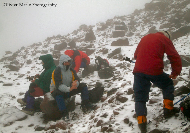
Special equipments: For the glacier cramps, belt and rope are advised. Seen the night-temperatures and the possibilities of snowstorm, glasses, gloves, gaiters, tooth and warm clothes are welcome.
Services: Posada La Estación, to Urbina, offers all the usual services. But for basic needs it is necessary to foresee everything to Riobamaba, there is no shop available on Urbina.
.JPG)
.JPG)
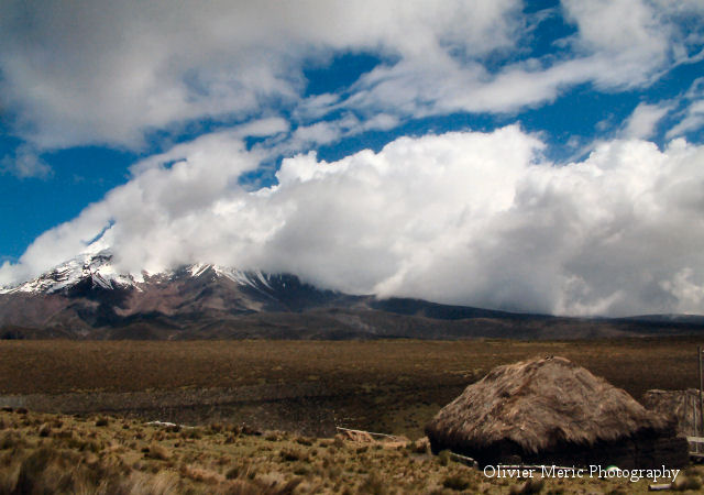
Trek: The Carihuairazo (Virile cold wind) measures 5116 m, its various summits were affected by the violent winds and the glacier activity. It is an extinct volcano, a small brother of the giant Chimborazo who peaks ( 6310 m), 8 Km between them. In the middle of these two volcanoes extends a dry páramo valley with a low vegetation but flowered what does not miss to attract several sorts of hummingbird. You will have the occasion to see some rabbits but especially many Vicuñas, Alpacas and Guanacos who are more usually known as Lama in Europe. The trek follows the Rio Moch valley on the Chimborazo side up to the Abraspungu pass then up to the glacier. The return by the North part of the Rio Mocha valley by the Carihuairazo side down to the village "12 de Octubre".
Access: the trek begins on the freeway at 25 Km of Riobamba. Buses will stop you close to Urbina.
Road: From the old Urbina station, in the direction of Santa Rosa of Chunquipogyos, the road crosses various cultivated fields at Chimborazo feet. After the Chunquipogyo hacienda we shall take the direction of Loma Caparina (4000m). Then, having crossed Gulag Río and Gavilán Machay Río , the road rises seriously towards the Gavilán Machay Loma . From the crest (4400m) you can admire the Carihuairazo in the South and the Chimborazo in the North before coming down again in the Abraspungu pass by the Cocha Negra lagoon. This pass is the waters division point, the rain which falls on the West will join the Pacific following The Guaya Río (150 Km), the one who falls in the East will join the Atlantic Ocean in more than 3500 km by following the Amazon.
.JPG)
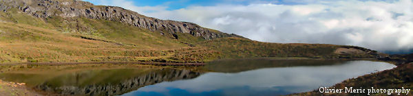
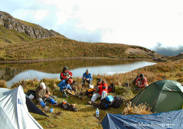
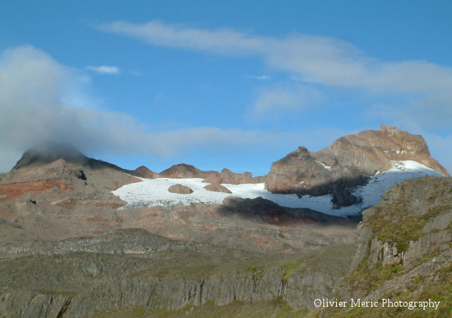
One kilometre separates us from the camp at the edge of a lagoon on the Westside of the Piedra Negra Loma cliff.
Day 2 : The next day, morning departure to join the Carihuairazo glacier where we shall equip ourselves to cross the glacier up to the highest summit foot.
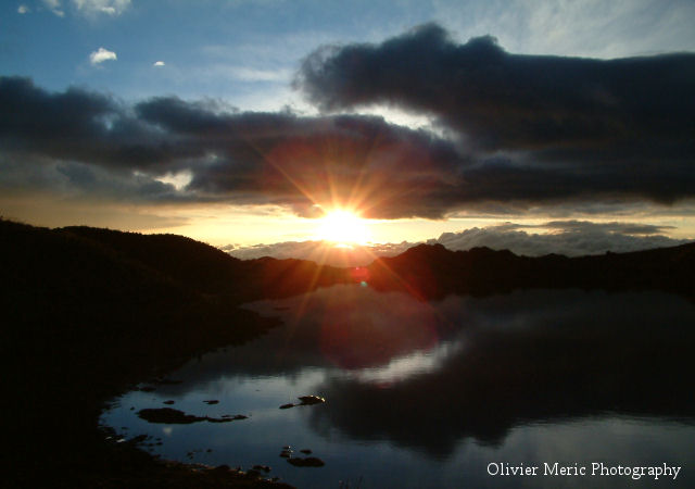
For return we shall take the same road down to the Abraspungu pass then by following the Carihuairazo Southside over Rio Mocha the valley. We shall join Tigre Saltana Río where we shall establish the camp. Here is a magnificent sight over the Chimborazo and a Rio Mocha waterfall.
Day 3 : Return in Pan-American highway by coming down along the Cachahuaycu crest. Farther, the path becomes a small road which leads to Mocha, but we shall take a small shortcut by Loma Chillabulla and "12 of Octubre" village to avoid 10 km of walking Return to Riobamba once on Pan-American.
.JPG)
 The
price includes....
The
price includes....
- Transport, guide, meals, all the necessary equipment for the campsite except sleeping bag, entrance fee to the Chimborazo national park.
The
price does not include....
- Tips, personal equipments and alcoholic drinks.
to
know....
- The organisation and your safety is ours priority, we reserve the right to be able to modify the trekking route according to the level and the possibilities of the group or for climatic reasons. Our Ecuadorian guides are licencied by the ministry of the tourism.
- It is recommended to have its own walking shoes, not supplied sleeping bag.

Copyright(c) 2003 Chimbo Niño. All
rights reserved.
[email protected]